
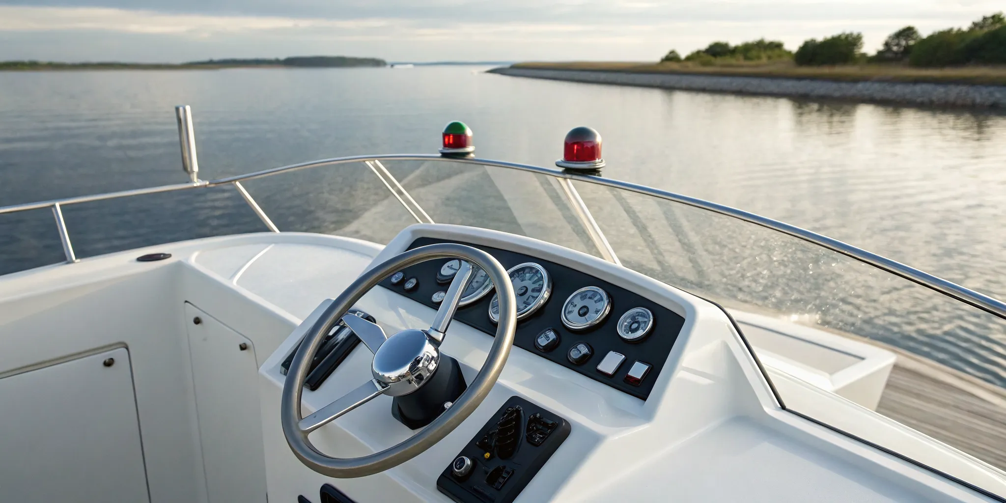
Maybe you’ve spent years enjoying the water from the passenger seat, watching someone else handle the docking and the charts. Now, you’re ready to be the one at the helm. Making that leap from passenger to captain is an exciting step, and it all starts with building a solid foundation of knowledge. This guide is designed to be your first mate, walking you through the essential boat navigation basics you need to feel competent and in control. We’ll cover the core rules, tools, and skills that transform a beginner’s hesitation into a captain’s confidence, preparing you to take charge of your own adventures on the water.
Key Takeaways
- Learn the Language and Your Tools: Start by learning key terms like port and starboard, then get comfortable using both modern GPS and traditional tools like a paper chart. Having a backup plan for your electronics is a non-negotiable part of safe boating.
- Know the Rules and Read the Water: Always follow the “rules of the road” to know who has the right-of-way, and respect posted speed limits. Just as important, check the tides, currents, and marine forecast before you leave the dock to avoid any surprises.
- Prioritize Preparation and Practice: Make a pre-departure check and sharing a float plan part of your routine. The best way to build lasting confidence is through consistent, hands-on practice in a supportive environment, which turns knowledge into true skill.
Key Navigation Terms to Get You Started
Before you can confidently guide a boat through the water, you need to speak the language. Boating has its own set of directional terms that are universal, ensuring every captain understands instructions clearly, no matter which way they are facing. Learning these basics is the first step toward feeling comfortable at the helm and is a core part of the hands-on training we provide to all our members. It might feel like learning a new dialect at first, but these terms will become second nature in no time.
Think of it this way: when you’re on the water, “left” and “right” can be confusing because they change depending on your position. The following nautical terms provide a fixed point of reference, keeping everyone on the same page. Mastering this vocabulary isn’t just about sounding like a seasoned sailor; it’s about safety, clear communication, and building the confidence you need to truly enjoy your time on the water. Let’s walk through the most essential terms you’ll hear and use on your adventures out of Boston or our North Shore and Cape Ann locations.
Port and Starboard
This is the big one. Port refers to the left side of the boat when you are facing forward, and starboard refers to the right side. If you have trouble remembering which is which, here’s a simple trick: “port” and “left” both have four letters. It’s an easy way to keep them straight when you’re just starting out.
These terms are crucial for communication, especially when another boat is approaching or when you’re docking. If someone tells you there’s another vessel off the starboard side, you’ll know exactly where to look without any confusion. This universal language is a key part of safe boating practices and helps prevent accidents on the water.
Bow and Stern
Just as important as port and starboard are the terms for the front and back of the boat. The bow is the very front, and the stern is the very back. It’s that simple. You’ll hear these words used all the time, whether you’re talking about dropping anchor from the bow or watching the wake from the stern.
Knowing these terms helps you understand instructions and describe what’s happening around you. For example, someone might ask you to grab a line from the bow locker or tell you to watch for a marker off the stern. Getting comfortable with this vocabulary is a fundamental part of your journey to becoming a skilled and confident boater.
Draft, Heading, Bearing, and More
Ready for a few more? The draft of a boat is the vertical distance from the waterline to the bottom of the hull. This tells you the minimum depth of water a boat needs to float without running aground. Each boat in our fleet has a different draft, which is important to know when exploring shallower areas.
You’ll also hear about heading and bearing. Your heading is simply the direction the bow of your boat is pointed, usually shown on a compass. A bearing, on the other hand, is the direction from your boat to a specific landmark or object, like a buoy or a lighthouse. Understanding the difference helps you follow a planned route and accurately pinpoint your location.
What Navigation Tools Do You Actually Need?
Stepping onto a boat is a bit like preparing for a road trip. You need to know where you’re going and have the right tools to guide you. On the water, this means having a mix of classic and modern navigation equipment. While our boats at Carefree Boat Club come equipped with the latest technology, understanding every tool at your disposal is key to feeling confident and safe. Let’s walk through the essentials you’ll find on board and why each one plays an important role in your day on the water, whether you’re exploring near Gloucester or heading out from our Boston or North Shore locations.
Traditional Tools: Compass and Paper Charts
Before digital screens lit up our dashboards, boaters relied on a handful of simple, effective tools. Think of these as your reliable, “unplugged” navigation kit. The most important are a magnetic compass and paper nautical charts. A compass always points north, giving you a constant, reliable sense of direction. Paper charts are detailed maps of the waterway, showing you water depths, shorelines, navigation aids, and potential hazards. To use them effectively, you’ll also want a pair of dividers to measure distance and parallel rules to plot your course. These tools don’t need batteries or a satellite signal, making them your most dependable backup.
Modern Tools: GPS and Chartplotters
Modern navigation tools make boating more accessible and straightforward than ever. The centerpiece of any modern boat is the GPS chartplotter. This device is your digital command center, displaying an electronic chart and showing your boat’s exact position, speed, and direction in real time. Our luxury fleet comes equipped with these systems. Other helpful electronics include a depth finder, which tells you how deep the water is beneath your boat, and a VHF radio for communicating with other boats and the Coast Guard. These tools work together to give you a clear picture of your surroundings, making your trip smoother and safer.
Why You Need Both—Not Just One
So, if you have a fancy GPS, why bother with paper charts? Because technology can fail. A dead battery, a software glitch, or even intense sun glare on the screen can leave you without your primary navigation tool. That’s when your traditional skills become essential. Knowing how to use a compass and read a paper chart is more than just a nod to the past; it’s a fundamental boating skill that ensures you can get home safely, no matter what. Think of it as your ultimate safety net. Being prepared with both modern and traditional tools is the hallmark of a smart, confident boater.
How to Read a Nautical Chart
Think of a nautical chart as your roadmap for the water. It’s a detailed map that shows you everything from water depths and bottom characteristics to navigational aids and potential hazards. While the GPS on your boat is an incredible tool, knowing how to read a paper chart is a fundamental skill. Electronics can fail, but a paper chart and a compass will always be there for you. Learning this skill gives you the confidence to explore the waters off Boston or find a quiet cove near Danvers with complete peace of mind. It’s all about understanding the language of the sea so you can stay safe and enjoy your day.
Understanding Depths, Hazards, and Symbols
At first glance, a nautical chart can look like a jumble of numbers and symbols, but it’s actually telling a very clear story. The numbers scattered across the water indicate depth at mean lower low water (the average lowest tide). The colors also give you clues: blue for water, and typically tan or green for land. You’ll also find symbols for things like rocks, shipwrecks, lighthouses, and buoys. The key is to learn what these symbols mean so you can identify safe passages and steer clear of hazards. Knowing the depths helps you avoid running aground, which is especially important when exploring the beautiful but sometimes tricky coastline around Gloucester.
Reading Chart Scales and Abbreviations
Just like a road map, a nautical chart is drawn to scale. However, it uses nautical miles instead of standard miles. This is why boat speed is measured in knots; one knot is equal to one nautical mile per hour. Understanding this relationship helps you estimate how long it will take to get from one point to another. Charts also use a lot of abbreviations to keep from getting too cluttered. You don’t have to memorize them all right away. Every chart has a legend, and you can reference NOAA’s Chart No. 1, which is the official guide to all symbols and abbreviations used on U.S. charts.
Using Charts with Your GPS
Your boat’s GPS or chartplotter is essentially an electronic nautical chart. It’s a fantastic tool that shows your boat’s exact position, speed, and direction in real-time. The best way to use it is in tandem with your paper chart. You can plot a course on your GPS, but always double-check it. Zoom in on your route to make sure you aren’t cutting across a shallow area, a restricted zone, or a patch of land you might not see on a wider view. Actively using your chartplotter, rather than just blindly following a line, is a critical part of situational awareness on the water.
How to Read Waterway Markers and Buoys
Think of the markers and buoys you see on the water as the traffic signs of the sea. They guide you through safe channels, warn you of hidden dangers, and keep boating orderly for everyone. While they might look confusing at first, they follow a simple and consistent system. Once you learn the basics of what the different colors and shapes mean, you’ll be able to read the water with confidence. This is one of the most important skills you can develop as a boater, and with a little practice, it becomes second nature. At Carefree, our on-water training ensures you get comfortable with these real-world navigation aids, whether you’re leaving from Boston or exploring the waters off Gloucester.
Red “Nuns” and Green “Cans”
The most common markers you’ll encounter are red and green, which outline the edges of safe water channels. To make them easy to tell apart, they have distinct shapes and a numbering system. Red markers are triangular, have even numbers, and are often called “nuns.” Green markers are square or rectangular, have odd numbers, and are nicknamed “cans.” An easy way to remember the numbering is that the numbers on the markers increase as you head inland from the open sea. These channel markers and buoys are your primary guides for staying in deep, unobstructed water, so learning to identify them quickly is a key part of responsible boating.
The “Red, Right, Returning” Rule
Here’s a simple phrase that will stick with you: “Red, Right, Returning.” This is the golden rule for using channel markers. It means that when you are returning from open water (like the ocean) and heading toward port or upstream, you should keep the red, even-numbered “nun” buoys on your right (starboard) side. The green “can” buoys will be on your left (port) side. The opposite is true when you’re heading out to sea; you’ll keep the green markers to your right. Mastering this rule is fundamental to safe boating, and it’s a core part of the hands-on training we provide to all our members as part of their membership.
Spotting Hazard Indicators and Other Markers
While red and green markers define safe channels, other buoys serve as warnings or provide information. You might see markers with black and red horizontal bands, which indicate an isolated danger like a rock or wreck that you should not get too close to. White buoys with orange markings often signal non-hazardous information, like designated swimming areas, speed limits, or mooring spots. A simple rule to remember is “red and green, stay between.” This helps you stick to the marked paths of deeper water. Always be on the lookout for these different aids to navigation, as they provide critical information about what lies beneath the surface and how to proceed safely.
The Rules of the Water: Who Has the Right-of-Way?
Just like driving a car, boating has its own rules of the road that keep everyone safe and the waters orderly. Knowing these basic navigation rules isn’t just about being a responsible boater; it’s essential for preventing accidents and ensuring a stress-free day for you and everyone else. The core idea revolves around two types of vessels in any given situation: the “stand-on” vessel, which has the right-of-way and should maintain its course and speed, and the “give-way” vessel, which must take early and clear action to stay out of the other boat’s way.
Understanding who has the right-of-way in different scenarios, from crossing paths with another powerboat to sharing the water with kayakers, is fundamental. It’s also crucial to remember the most important rule of all: do whatever it takes to avoid a collision. Even if you technically have the right-of-way, your top priority is always safety. This is a huge part of the hands-on training we provide to all our members, ensuring you feel confident before you even leave the dock. Our comprehensive membership is designed to give you all the skills you need to handle your boat with confidence.
Handling Head-On and Crossing Scenarios
When you’re out on the water, you’ll inevitably approach other boats. Knowing how to react is simple once you learn the rules. If a boat is approaching you head-on, the protocol is for both of you to steer to your right (starboard). This way, you will safely pass each other with the other boat on your left (port) side. Think of it as the standard “passing port-to-port” maneuver.
In a crossing situation, where another boat is approaching from your side, the rule is just as clear. If the boat is coming from your left (port side), you are the stand-on vessel and have the right-of-way. You should maintain your course and speed. The other boat must “give way” and alter its course to pass behind you. However, always stay alert. If the give-way boat isn’t changing course, you must take action to avoid an accident.
Motorized vs. Non-Motorized Boats
One of the most important right-of-way rules involves different types of vessels. Simply put, powerboats must always yield to non-motorized boats. This includes sailboats operating under sail, kayaks, canoes, paddleboards, and rowboats. The reason is straightforward: these vessels are much harder to maneuver and can’t get out of the way as quickly as a powerboat can.
Whether you’re cruising around Boston Harbor or exploring the waters off Gloucester, you’ll share the space with plenty of paddlers and sailors. As the operator of a powerboat from our fleet, it’s your responsibility to give them plenty of room. Always slow down and be prepared to alter your course to pass them safely, ideally from behind.
Observing Speed Limits and No-Wake Zones
Your boat’s wake, the trail of waves it leaves behind, can be disruptive and even dangerous in certain areas. That’s why you’ll see signs for “No Wake” zones, especially near marinas, mooring fields, shorelines, and bridges. A “No Wake” sign means you must reduce your speed to the slowest possible setting that still allows you to maintain steering control. The goal is to create no appreciative wake.
You might also see signs for “Slow Speed/Minimum Wake.” This allows for a little more speed than a no-wake zone, but you should still be going slow enough that your boat’s bow isn’t rising out of the water. Following these posted speed limits protects other boats from being rocked, prevents shoreline erosion, and ensures the safety of wildlife and people in the water. It’s a simple way to show respect for the shared marine environment.
How to Factor in Tides, Currents, and Weather
Beyond charts and buoys, the water itself is a dynamic force you need to understand. Tides, currents, and weather are the three biggest environmental factors that will shape your day on the water. Getting familiar with them isn’t just about advanced boating; it’s a fundamental part of staying safe and having a good time. A calm, sunny morning can quickly turn into a challenging afternoon if you aren’t paying attention to the forecast. Learning to read the water and the sky is just as important as learning to read a chart.
How Tides and Currents Affect Your Route
Tides and currents are the invisible hands that guide and push your boat. Tides are the vertical rise and fall of the water level, while currents are the horizontal flow of water. In coastal areas like the waters around Boston, North Shore and Cape Ann, tides can dramatically change water depths. A channel that is perfectly safe at high tide might become a shallow, hazardous area at low tide, putting you at risk of running aground. Always check the local tides before you go. Currents can also affect your route by pushing you off course or slowing you down, which means you’ll use more fuel and time than you planned. Factoring them into your navigation plan helps you stay on track and on schedule.
Check the Forecast Before You Go
This might sound obvious, but it’s a step you can never skip: always check the marine forecast before you leave the dock. Weather on the water can be much different than it is on land and can change in an instant. Look beyond just the chance of rain. Pay close attention to the predicted wind speed, wind direction, and wave heights. Strong winds can create choppy conditions that make for an uncomfortable and potentially unsafe ride. You can use reliable apps and websites to track weather conditions in real time. It’s also a good habit to check the forecast periodically throughout your trip, so you’re never caught by surprise by an approaching storm or a sudden shift in the wind.
What to Do When Conditions Change
Even with careful planning, you can find yourself in changing conditions. If the weather takes a turn, your first priority is always safety. If waves pick up or fog rolls in, slow down to a safe speed. If another boat is in your path and isn’t yielding, you must change your course to avoid a collision, even if you technically have the right-of-way. When conditions get rough, it’s a good idea to have everyone on board put on a life jacket. Don’t be a hero; if you feel uncomfortable, the smartest thing to do is to head back to the marina or find a sheltered cove to wait it out. Knowing how to handle rough seas is a skill that gives you confidence on the water.
Your Pre-Departure Safety Checklist
A great day on the water starts with a few simple checks before you even cast off the lines. Running through a pre-departure checklist helps ensure every trip is as safe as it is fun. It’s a simple habit that gives you peace of mind, letting you focus on the beautiful views and the company you’re with. At Carefree Boat Club, our boats are meticulously maintained, but as the captain, you always have the final say. Here’s what to review before heading out from one of our locations in Boston or on the North Shore.
Pack Your Essential Safety Gear
Every boat is required to have specific safety equipment on board, and it’s smart to know where it all is before you need it. This includes enough life jackets for everyone, a fire extinguisher, and a sound-producing device like a horn or whistle. While our team ensures every boat in our fleet is fully equipped and ready to go, it’s a good practice to do a quick visual check. Make sure you see the orange life jackets and know where the extinguisher is stored. This quick step takes only a minute and builds your confidence as a captain.
Create and Share a Float Plan
A float plan is simply telling someone on shore where you’re going and when you expect to return. It doesn’t have to be a formal document; a text message to a friend or family member with your destination, route, and estimated return time works perfectly. This is one of the most effective safety nets you can create. If you’re delayed for any reason, someone knows your general location and can alert authorities if needed. For a more detailed plan, you can use the U.S. Coast Guard’s official template as a guide for what information to include.
Maintain Safe Speeds and Situational Awareness
Once you’re on the water, your most important job is paying attention. Always operate at a safe speed, especially in crowded channels or areas with swimmers. Keep an eye on the weather and be aware of how tides and currents might affect your boat. Situational awareness means looking all around you, not just straight ahead. Watch for other boats, be mindful of no-wake zones, and give paddleboarders and kayakers plenty of space. The comprehensive training included with your membership covers these rules of the water, preparing you to handle your boat with skill and courtesy.
What to Do If Your Electronics Fail
Modern GPS and chartplotters are incredible tools, but it’s wise to have a backup plan in case your electronics fail. That’s why you should always know how to use traditional navigation tools. Having a basic understanding of how to read a compass and a paper chart is an essential skill for any boater. You don’t need to be an expert, but knowing how to find your general direction and position without a screen provides an invaluable layer of security. Think of it as a safety net you hope you’ll never need, but you’ll be glad you have if you do.
How to Practice Your Navigation Skills
Becoming a confident captain doesn’t happen overnight. Navigation is a skill, and like any other, it gets sharper with practice. While modern GPS and chartplotters are incredible tools, they aren’t foolproof. Electronics can fail, so knowing how to find your way with traditional methods is not just smart, it’s essential for safety. The good news is that practicing these skills can be a fun part of your boating adventures.
The best way to build your confidence is by getting out on the water and putting your knowledge to the test in calm conditions. You can start by using landmarks to pinpoint your location, planning routes before you leave the dock, and learning alongside experienced boaters. At Carefree Boat Club, we believe that confident boaters are safe boaters, which is why our membership includes unlimited on-water training. With a little practice, you’ll feel more comfortable and in control every time you head out from one of our locations in Boston the North Shore or Cape Ann.
Practice with Landmarks and Dead Reckoning
This might sound old-school, but using landmarks is a reliable way to confirm your position. This technique, often part of dead reckoning, involves using fixed objects on shore to figure out where you are on the water. On a clear day, try to find your boat’s location using what you can see. Look for three distinct landmarks, like a water tower, a bridge, and a lighthouse, that are also marked on your paper chart.
Point your boat or a handheld compass at each one to get its bearing. Then, use parallel rulers to draw lines from each landmark on your chart according to its bearing. The point where the three lines intersect is your position. It’s a great exercise to build your situational awareness and a solid backup skill to have.
Plan Routes Using Charts and Apps
A safe trip begins before you even untie the lines. Just as you’d map out a road trip, you should always plan your route on the water. Before you leave the dock, use a navigation app or your boat’s chartplotter to map out your intended path. This is the perfect time to check for any potential issues along the way.
Pay close attention to water depths and compare them to your boat’s draft (how deep it sits in the water) to avoid running aground. You can practice by planning a few hypothetical trips from Gloucester to a nearby beach or from Danvers to a favorite fishing spot. Getting familiar with the charts for your local waters is one of the best ways to prepare for a great day out.
Get Hands-On Training and Learn with Others
You don’t have to figure everything out on your own. Taking a boating safety course is a fantastic way to learn navigation rules, how to read charts, and what to do in an emergency. But nothing beats learning directly on the water with someone who knows the ropes. This is where hands-on training becomes so valuable, as it allows you to apply theoretical knowledge in a real-world setting.
At Carefree Boat Club, we handle all the training for you. Our members get unlimited instruction from our team of experienced captains on our entire fleet of boats. We’ll go out with you until you feel completely comfortable handling the boat and its navigation systems, ensuring you have the skills and confidence to enjoy your time on the water safely.
Get on the Water With the Right Support
Learning to navigate can feel like a lot to take in, and that’s perfectly normal. Reading articles and watching videos is a fantastic start, but true confidence comes from hands-on experience. After all, knowing the difference between port and starboard is one thing; applying that knowledge while managing tides, traffic, and weather is another. The key is to build your skills in a safe, supportive environment where you can ask questions and learn by doing.
That’s why many new and experienced boaters find that learning from a seasoned professional is the best way to get comfortable at the helm. An instructor can show you how to apply the rules of the water in real time and help you develop the situational awareness that makes a great captain. Having someone by your side to guide you through your first few outings can make all the difference, turning what could be a stressful experience into an empowering one.
At Carefree Boat Club, we believe that confident boating is safe and fun boating. That’s why every membership includes unlimited, on-water training with our team of professional instructors. We’re here to help you master everything from planning your route and reading a chart to docking on a windy day. Our goal is to give you the skills and support you need to feel completely at ease, whether you’re exploring Gloucester Harbor or cruising the Charles River.
When you join the club, you’re not just getting access to a beautiful fleet of boats; you’re gaining a dedicated support system. We handle all the maintenance, cleaning, and prep work so you can focus on what matters: building your skills and making memories on the water. With the right training and support, you can leave the dock with confidence and enjoy everything that boating around Boston, Cape Ann and the North Shore has to offer.
Related Articles
- Marine Navigation: How to Navigate a Boat
- Safe Boating Practices
- Boat Navigation Methods, Tools & Safety Guide
- Boating Basics: Basic Navigation
- Beginners Guide to Navigating a Boat
Frequently Asked Questions
This seems like a lot to learn. Do I really need to master all of this before I can go boating? It can feel like a lot at first, but you absolutely don’t need to be an expert overnight. Think of it like learning to drive a car; you start with the basics and build confidence with practice. The most important thing is to have a solid foundation in safety and the rules of the water, which is why hands-on training is so effective. You’ll find that once you’re out there, these concepts click into place and quickly become second nature.
Can I just use a GPS app on my phone instead of the boat’s chartplotter and paper charts? While a phone app can be a helpful secondary tool, it should never be your primary or only source of navigation. Your phone isn’t designed for the marine environment; it’s not waterproof, the screen can be hard to see in bright sun, and its GPS can be less reliable offshore. A boat’s dedicated chartplotter is built for the job, and a paper chart is your foolproof backup that never runs out of battery. Using all three gives you layers of security.
What’s the most important ‘rule of the road’ to remember on the water? The single most important rule is to do whatever is necessary to avoid a collision. While there are specific rules for who has the right-of-way in different situations, your number one job as captain is to keep everyone safe. This means always being alert and prepared to slow down, stop, or change course if another boater isn’t following the rules or if a dangerous situation is developing.
The ‘Red, Right, Returning’ rule is a bit confusing. Is there another way to think about it? It can be tricky to remember at first. Here’s a simple way to visualize it: when you are returning to port from the open sea, you are heading “home.” Think of the red channel markers as rolling out the red carpet for your arrival. By keeping that red carpet on your right side, you’ll be guided safely back into the harbor.
What should I do if the weather forecast was clear but conditions start to get rough? Even the best forecasts can be wrong, so your first step is to prioritize safety. Slow down to a speed that feels comfortable and controlled for the conditions. If you have passengers, it’s a good idea to have everyone put on a life jacket as a precaution. Most importantly, trust your gut. There is no shame in cutting a trip short and heading back to the dock if you feel uncomfortable. A smart captain knows their limits and always puts safety first.
https://shorturl.fm/vxUHe
https://shorturl.fm/5T9sb
https://shorturl.fm/MO2Yk
https://shorturl.fm/kr9OY